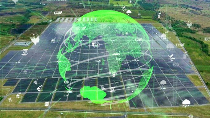
As the world races to reduce emissions and move away from fossil fuels, renewable energy has become one of the most important tools in tackling climate change. Solar farms, wind turbines, and hydropower stations are now visible symbols of progress in almost every part of the globe. But behind the scenes, what’s powering the smarter and faster deployment of these systems is satellite data.
These Earth observation records, stretching back over four decades, are helping developers and researchers plan renewable energy projects with greater precision. For example, with the long-trusted Landsat data archive, it’s possible to monitor land use changes, assess solar and wind potential, and ensure that installations have minimal environmental impact. It brings scale, clarity, and historical depth — elements that are crucial when making decisions that affect both the energy grid and the ecosystems around it.
How Effective Are Satellite Images for Renewable Energy?
Renewable energy depends heavily on geography. The amount of sunlight, the direction and strength of the wind, or the volume of river flow all determine how productive a site will be. Ground-level observations can only go so far, especially in remote or vast areas. This is where satellite images come in.
With high-resolution Landsat satellite images, we get a detailed and consistent view of Earth’s surface. These images make it easier to identify ideal locations for solar fields, map wind corridors, and monitor rivers for hydropower projects. Importantly, they also offer a time dimension. With regular revisits, we can track seasonal patterns, detect environmental degradation, and forecast conditions that affect energy production.
The real value is in the accuracy and consistency. Unlike sporadic site visits or incomplete land surveys, satellite imagery ensures that developers see the full picture before and after a project goes live.
Uses of Satellite Data in Renewable Energy
Satellite imagery is now deeply embedded in renewable energy workflows, from initial planning to long-term performance monitoring.
Solar energy developers use satellite data to assess surface reflectivity, track cloud cover, and estimate solar irradiance over time. With these insights, they can decide where to build and how to configure panels for maximum yield.
Wind energy projects benefit from elevation data, land cover analysis, and regional wind flow mapping — all possible with remote sensing. These layers help engineers avoid poor-performing areas and minimize disruption to surrounding land and communities.
Hydropower operations rely on satellite data to monitor water flow, measure sediment buildup, and assess flood risks. Having access to continuous data improves how they manage water resources, especially under changing climate conditions.
Bioenergy producers, too, use imagery to track biomass availability and avoid sourcing from areas under deforestation pressure.
In each of these cases, platforms that allow users to download Landsat data or browse it easily through an interface give project developers the tools they need to work faster and more responsibly.
Landsat 8 & EOSDA LandViewer in Renewable Energy
Of all the satellites in the Landsat series, Landsat 8 is particularly valuable for renewable energy applications. Launched in 2013, it captures high-resolution data across visible, infrared, and thermal bands. That combination makes it ideal for analyzing vegetation, surface temperature, land change, and more.
EOSDA’s LandViewer platform simplifies how users access and apply Landsat 8 satellite imagery. With it, you can search for specific regions, apply indices like NDVI or NBR, and view seasonal trends without any technical background in GIS. More importantly, you can export and download Landsat imagery for further use.
In the context of renewable energy, that means users can:
- Spot optimal locations for solar panels based on temperature and reflectivity data
- Track changes in vegetation or moisture that may affect wind turbine foundations
- Measure long-term trends in water levels for hydropower
- Monitor land stability and environmental health around renewable energy infrastructure
Beyond energy, the platform also supports work in climate monitoring, environmental protection, and land restoration, areas closely tied to the long-term sustainability of the energy transition.
What Is the Future of Renewable Energy with Satellite Imagery?
Looking ahead, the relationship between satellite data and renewable energy will only grow stronger. As Earth observation technology advances, the imagery we rely on will become more detailed, more frequent, and more actionable.
For example, future satellites will be able to monitor solar farms almost in real time, detecting faults or drops in performance. Wind energy operators could use near-instant imagery to respond to environmental changes like erosion or flooding. With improvements in cloud computing, users won’t just download Landsat images, they’ll be able to process them directly in the browser, running AI models that recommend actions or flag risks.
Accessibility will improve, too. Already, platforms that guide users on how to get Landsat data are opening the door for smaller companies, nonprofits, and local governments to participate in the renewable transition.
At the same time, satellite data will play a vital role in ensuring the renewables industry stays accountable. Environmental monitoring from space will help verify sustainable land use, track carbon impacts, and ensure that large-scale projects do not cause unintended harm.
Actually, the clean energy transition isn’t just about swapping gas for solar panels. It’s about designing smarter systems, using better data, and minimizing harm while maximizing impact. And in this transformation, satellite data is more than just a helpful tool. Whether you’re trying to assess solar potential, map wind corridors, or ensure your project aligns with sustainability goals, satellite imagery gives you the vision and the context to make smarter choices. And with tools like EOSDA LandViewer putting decades of data at your fingertips, there’s no reason to fly blind.
Author:
Vasyl Cherlinka is a Doctor of Biosciences specializing in pedology (soil science), with 30 years of experience in the field. With a degree in agrochemistry, agronomy and soil science, Dr. Cherlinka has been advising on these issues private sector for many years.


